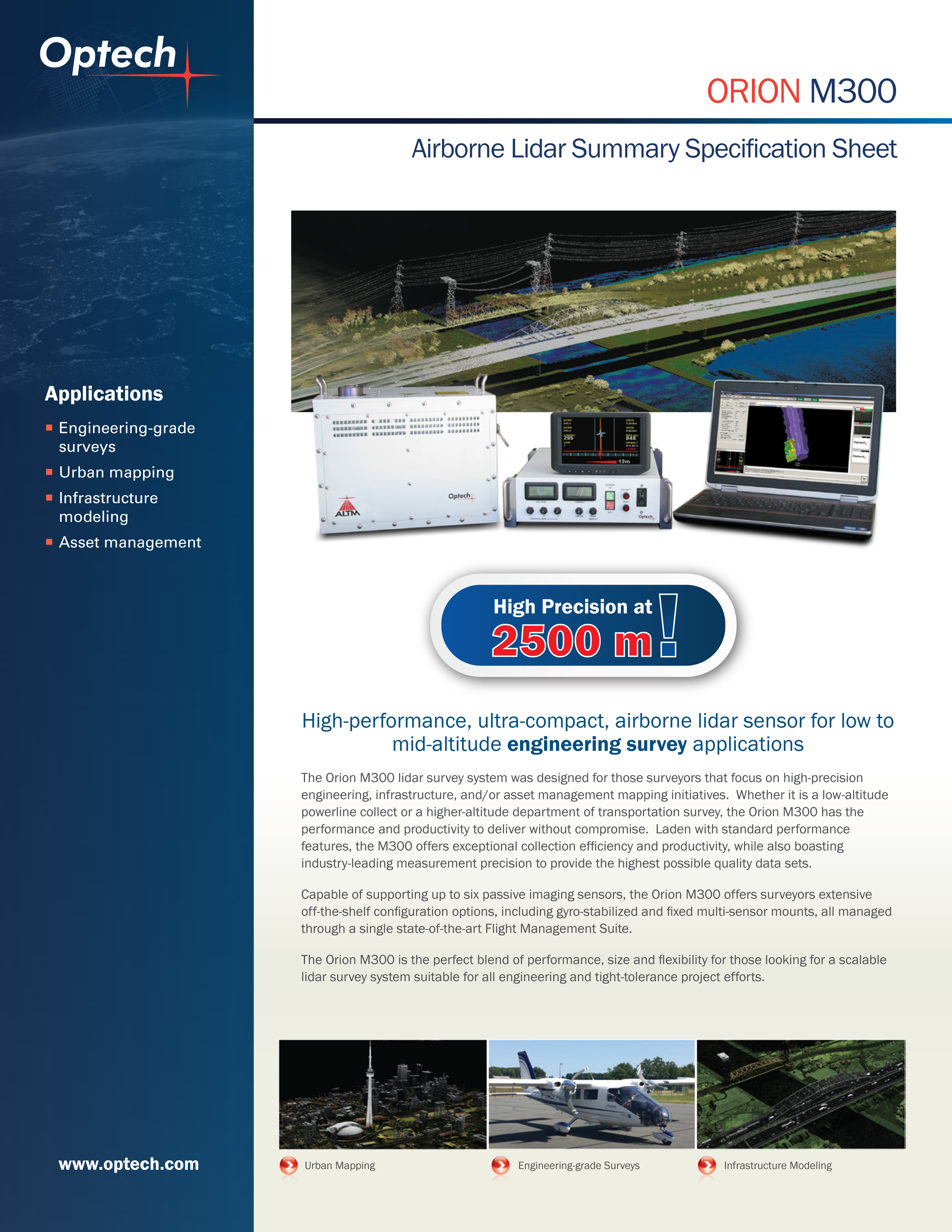
Terra Flight Aerial Imaging provides LiDAR data acquisition services using a Teledyne Optech Orion H-300 LiDAR sensor capable of producing high density point cloud data. This data is used to support a variety of projects such as corridor transportation projects, oil and gas property surveys, pipeline surveys, urban flood plan and many types of wide-area mapping projects.
TFAI operates our LiDAR sensor throughout Texas and the surrounding states.
Teledyne Optech Orion LiDAR Sensor
.jpg)
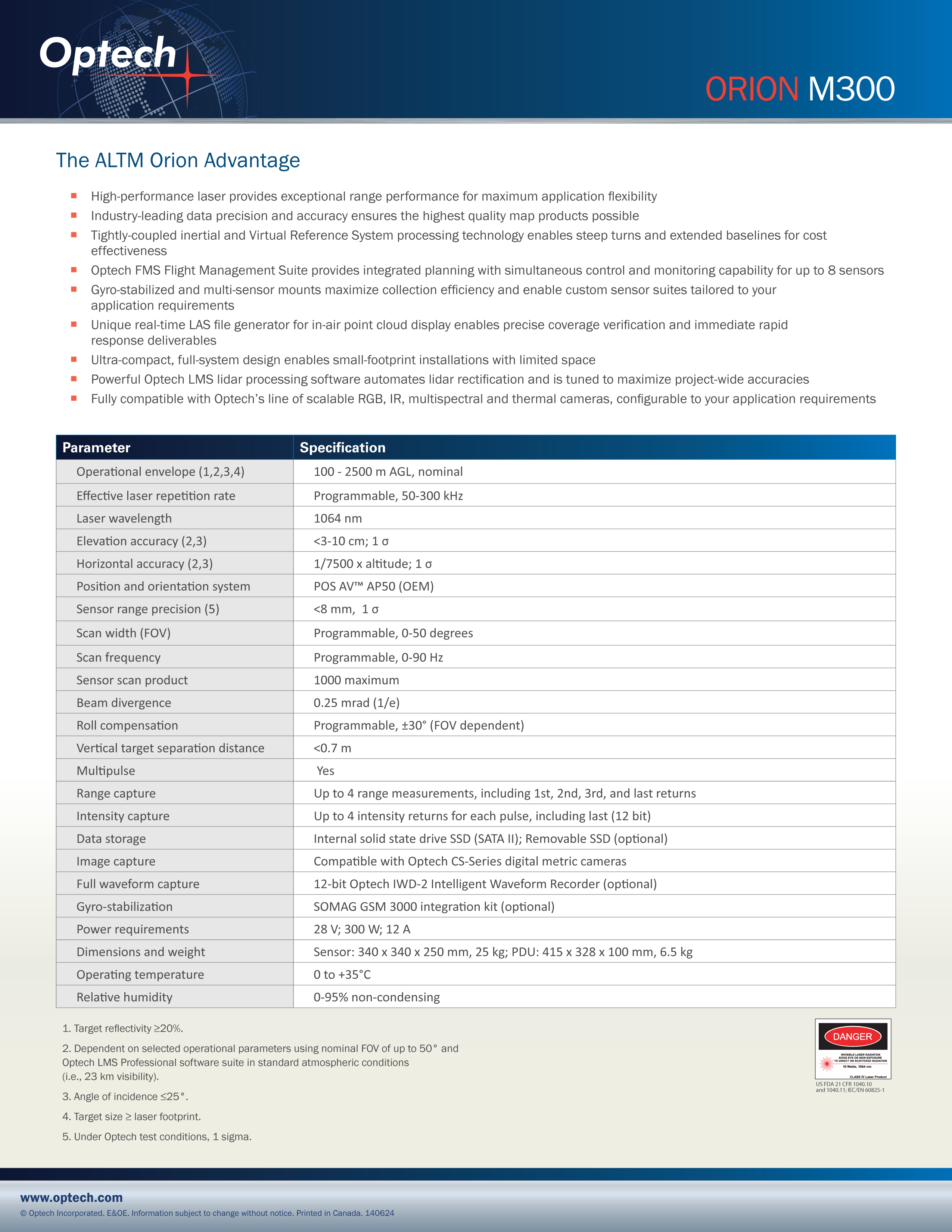
SPECIFICATION SHEET